Strong system to bring heavy rain and a quick shot of snow Monday night
CHARLESTON, W.Va. (WCHS) — After the big game last night, we are off to a quiet start early on this Monday, but that will be changing as we head into the evening.
An area of low pressure coming up from Tennessee will push heavy rain our way.
Out ahead of this system , sunshine will be hard to come by for most of us - high temperatures look to reach the lower 50s under mostly cloudy skies. Temps could reach the mid 50s closer to the Ohio River where a few peeks of sun will be more likely.
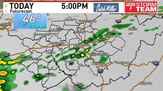
As more moisture arrives later this afternoon on a strengthening south wind aloft, expecting a few showers to develop.
This means the evening drive home will begin to turn wet.
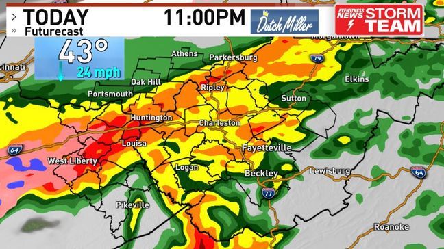
However, the best combo of moisture and energy will arrive a little after dinnertime - this is when the rain will really pick up. Travel conditions here will be poor due to ponding, spray kickback and poor visibility.
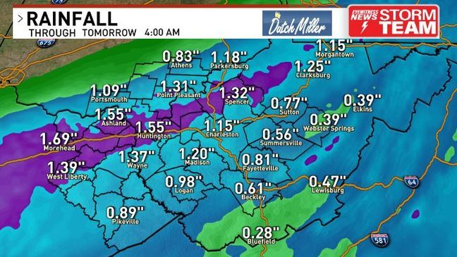
A quick one to two inches of rain looks to fall areawide. While it has been dry recently, this amount of rain can still lead to a lot of runoff and perhaps minor flooding in poor drainage and low-lying areas.
This plume of moisture coming up from the Gulf of Mexico may actually destabilize our air enough for a thunderstorm or two - this looks a little more likely further south and east you go.
As this low-pressure tracks towards the Mid-Atlantic coast overnight, our winds will shift out of the northwest and pick up.
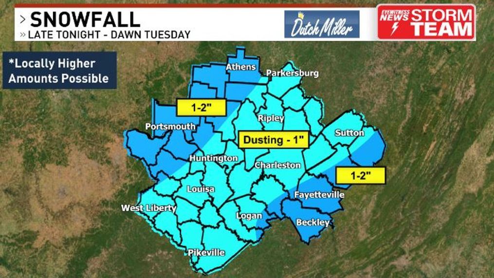
This will draw in colder air on a gusty breeze, which will allow any remaining moisture to change over to some wet snow closer to dawn. This will occur earlier across portions of Ohio and Kentucky.
This snow will not last long at all. In fact, most of the models show this wet snow moving away east before the sun comes up.
So that's a couple hours worth of snow falling atop a warmer ground with marginal temperatures. That simply doesn't equate to a significant snowfall.
Most of us should see a dusting of snow, mainly on the grassy surfaces - but the higher spots could see about an inch of wet snow.
Roads should stay just wet as temps only look to bottom out in the lower 30s. However, further west into portions of Ohio and Kentucky, colder temps can allow for a little more snow accumulation and slick conditions.
Again, the elevated spots like bridges and overpasses would be most at risk there. Wouldn't entirely be shocked if there was an isolated three inches amount back into northeast Kentucky, but most of that corridor should fall in the one to two inch range.
Whatever snow does occur will quickly melt later in the morning and afternoon, as temperatures look to climb into the 40s under some sunshine and clouds.
A breeze out of the west will make things feel chillier, though. A few, scattered rain/snow showers may redevelop later in the day - mainly across our eastern and northern counties.
If you don't like these colder temps, this is something that is a little more spring-like. Today is our first 6 p.m. sunset since fall. A month from now, we'll see a huge jump with our sunset occurring at 7:30 p.m. on March 12 thanks to daylight saving time beginning.
While our temps aren't as warm as what we've seen, they are still aren't too bad with most days reaching the 40s - that's seasonable for this time of the year. Even a milder day sprinkled in there on Thursday thanks to a low-pressure tracking into the Great Lakes.
Valentine's Day will be rather cool, but it's looking dry under sunshine and a few clouds.
Beyond this, it still looks seasonably chilly with perhaps a few snow chances, but climate signals over the weekend aren't as strong in showing colder air.
Arctic air is unlikely with this look, plus the sun is only getting steeper and stronger with each passing day now.
Have a Great Week!
WCHS Storm-Team Meteorologist Brandon Stover


